The country between the Oxus and the Indus (1935)

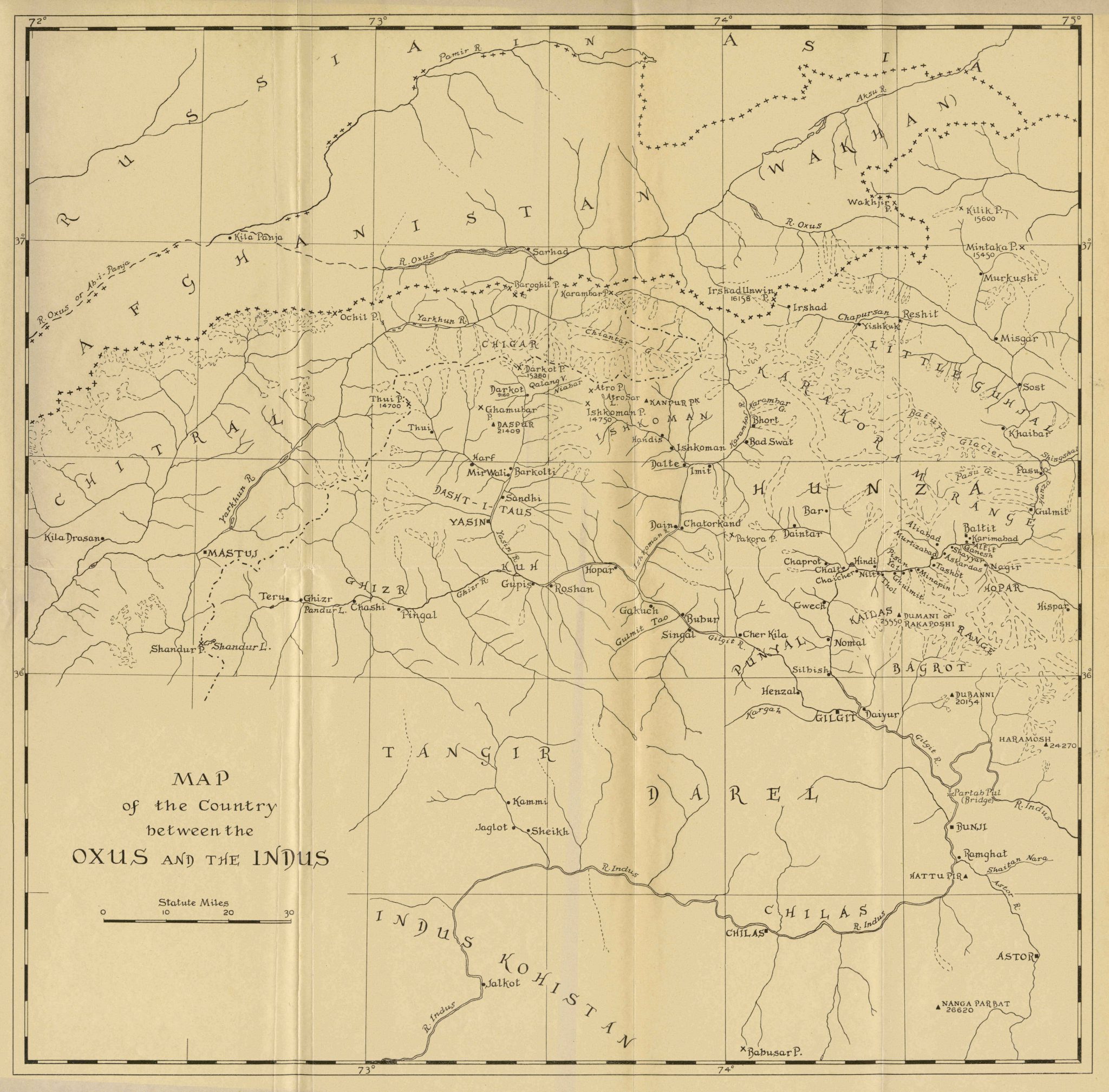
This pencil sketched map is from the book Between the Oxus and the Indus (1935) written by Colonel Reginald C. F. Schomberg. It shows the area between the Oxus River (also known as the Amu-Darya) in Afghanistan, and the Indus River in Kohistan, a territory called the Gilgit Agency, which was at the time under British rule and administered by officials appointed by the Maharaja of Kashmir. The map is a complement to the geographical and historical accounts of the Gilgit Agency offered by the author after several journeys in the region during a period of eight years. It is a detailed map with cities and towns marked out along rivers and topographical data about mountains. To the south one can see the Tangir and Darel valleys and the Chilas district, to the west the state of Chitral, and to the east the states of Hunza and Punyal as well as the cities of Gilgit and Baltit and the Karakoram mountains. In the center of the map there are the states of Ghizr, Ishkoman and Kuh and the city of Yasin.
