Central Asia (1908)

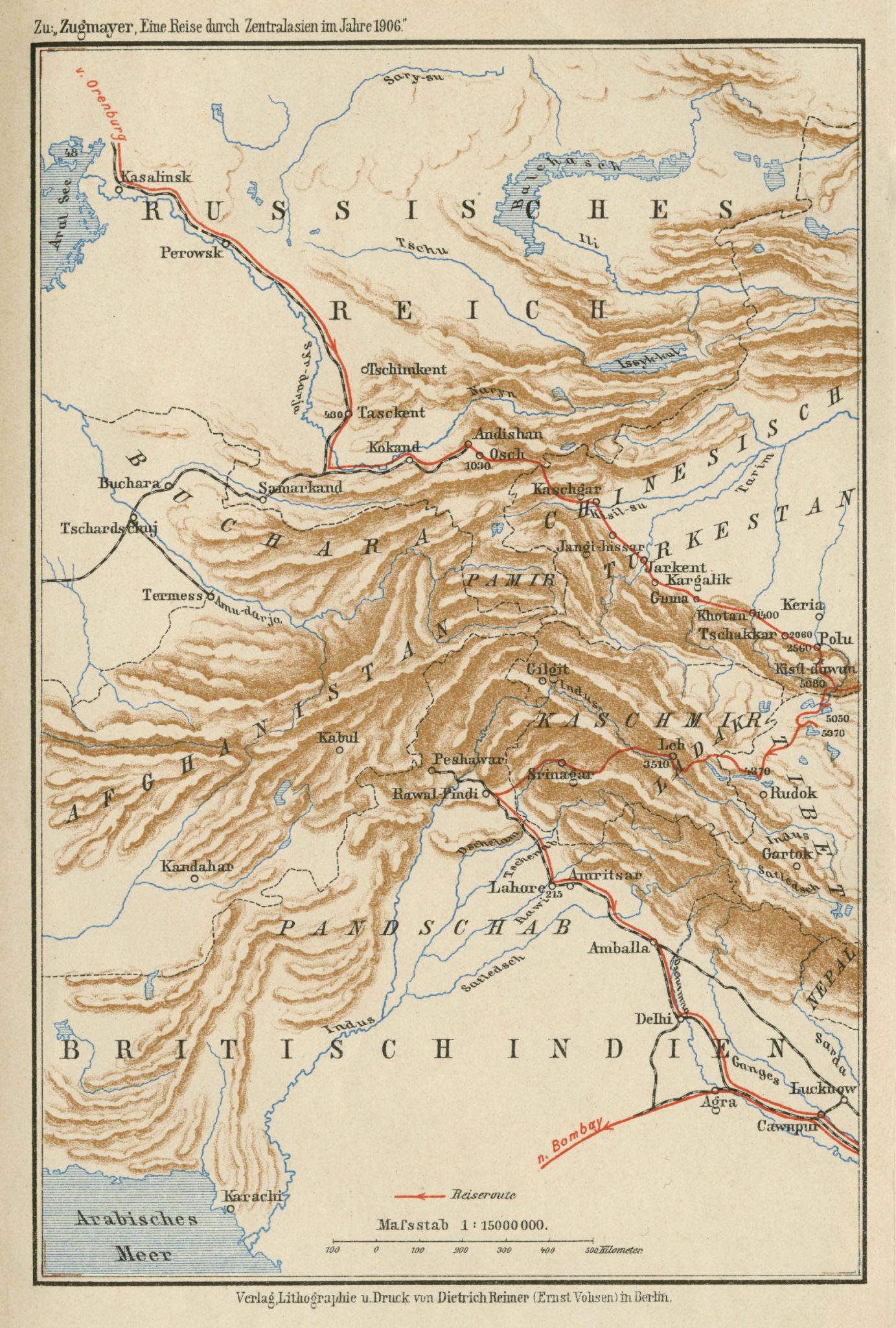
This map of Central Asia can be found in appendix to Eine Reise durch Zentralasien im Jahre 1906 written by Erich Zugmayer and published in 1908. It is a large-scale map in color illustrating the mountainous intersection of Chinese Turkestan, Russian Turkestan, Afghanistan and British India. The travel route of the author is indicated in red, going through the cities of Delhi in India, Srinagar and Leh in Kashmir to the south, Keriya, Yarkand, and Kashgar in Chinese Turkestan to the east, and Kokand, Samarkand and Tashkent in Russian Turkestan to the north of the map. Rivers, lakes, towns, and railroads are illustrated in this map.
