Tsarist Russian Central Asia (1909)

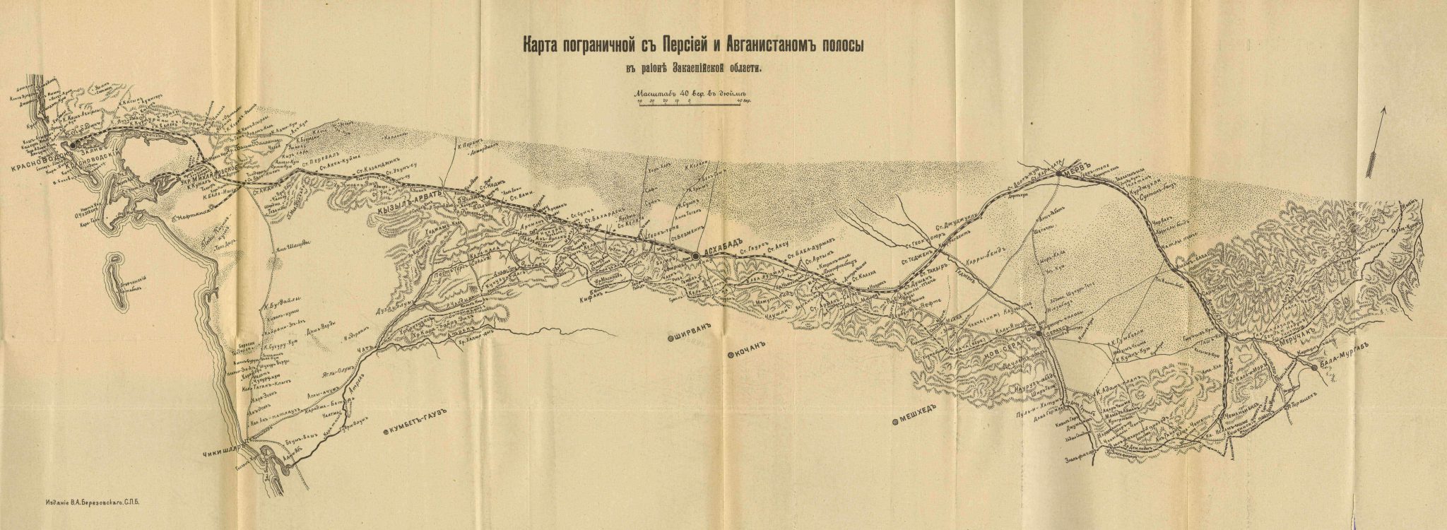
This detailed map of the southern part of Russian Turkestan can be found in appendix to На границахь Средней Азии [On the borders of Central Asia] written by D. N. Logofet and published in (1909). It is a colored, pencil-sketch map providing geographical information about the Samarkand region, the Fergana region and the Russian territory north of the Afghan border. The Zarafshan River appears in the centre of the map, flowing through the cities of Bukhara and Samarkand, while the Amu Darya can be seen to the west. Railway tracks running from west of Bukhara eastward to Samarkand, Tashkent, Marghelan, and Andijan are marked out. Another map from the same book shows the Transcaspian railway from Krasnovodsk to Merv.
See also:
Na granitsax’ Sredney Azii:
putevye ocherki v 3-x’ knigax’: 1-3 (1909)
The Transcaspian region (1909)
.