Eastern Turkestan and the northern territory of the Tibetan Plateau (1949)

This map of Eastern Turkestan can be found in an appendix to Путешествие в Кашгарию и Кун-Лунь [Journey to Kashgaria and Kunlun], written by Russian traveler and explorer M. V. Pevtsov and published in 1949. It is a small-scale map providing detailed geographical information about the region surrounding the Takla Makan Desert, compiled during the author’s expeditions in 1889-90, during which mappings and astronomical measurements were conducted. To the west one finds the cities of Kashgar, Yarkand and Karghalik. The city of Hotan and the Karakoram Mountains can be found to the south. The Takla Makan Desert is found in the center and the Issyk-Kul Lake in the north-west. The city of Urumchi and its northern surroundings are presented in an inset map in the upper corner of the bigger map.
This map is essentially the same as “Map of Eastern Turkestan and the northern territory of the Tibetan Plateau” published in 1895 in the first volume of Труды тибетской экспедиции 1889-1890 гг. подъ начальствомъ М. В. Певцова [Works of the Tibetan expeditions of 1889–1890 under the supervision of M. V. Pevtsov]. However, the style of sketching and coloring of the two maps differs, as does the orthography: the map from 1895 uses an older version of the Russian-Cyrillic script. Furthermore, the scale is indicated in kilometers in the present map and in versts in the other version.
See also:
Puteshestvie v Kashgariyu i Kun-Lun’ (1949)
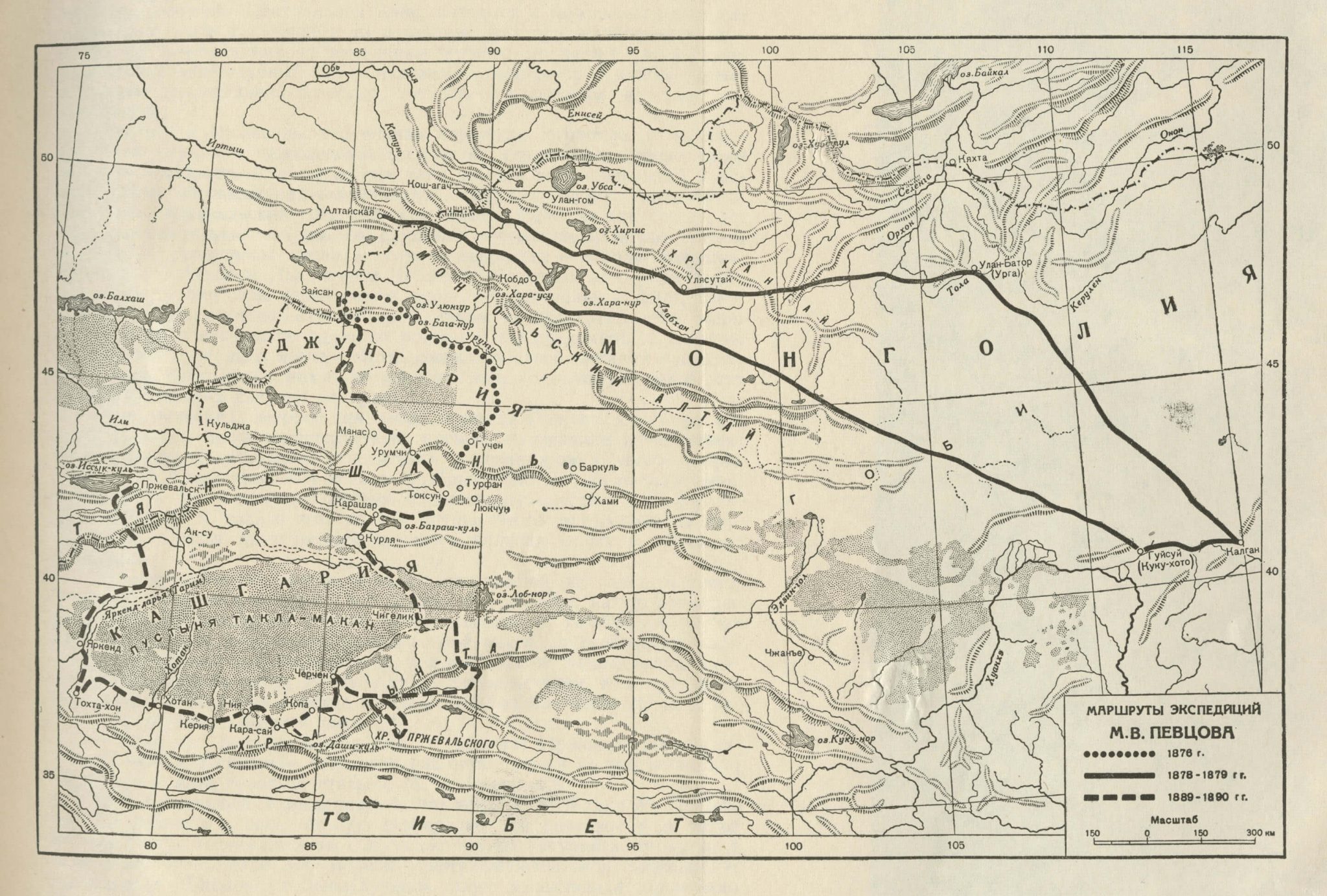
Pevtsov’s expedition routes in Eastern Turkestan (1949)
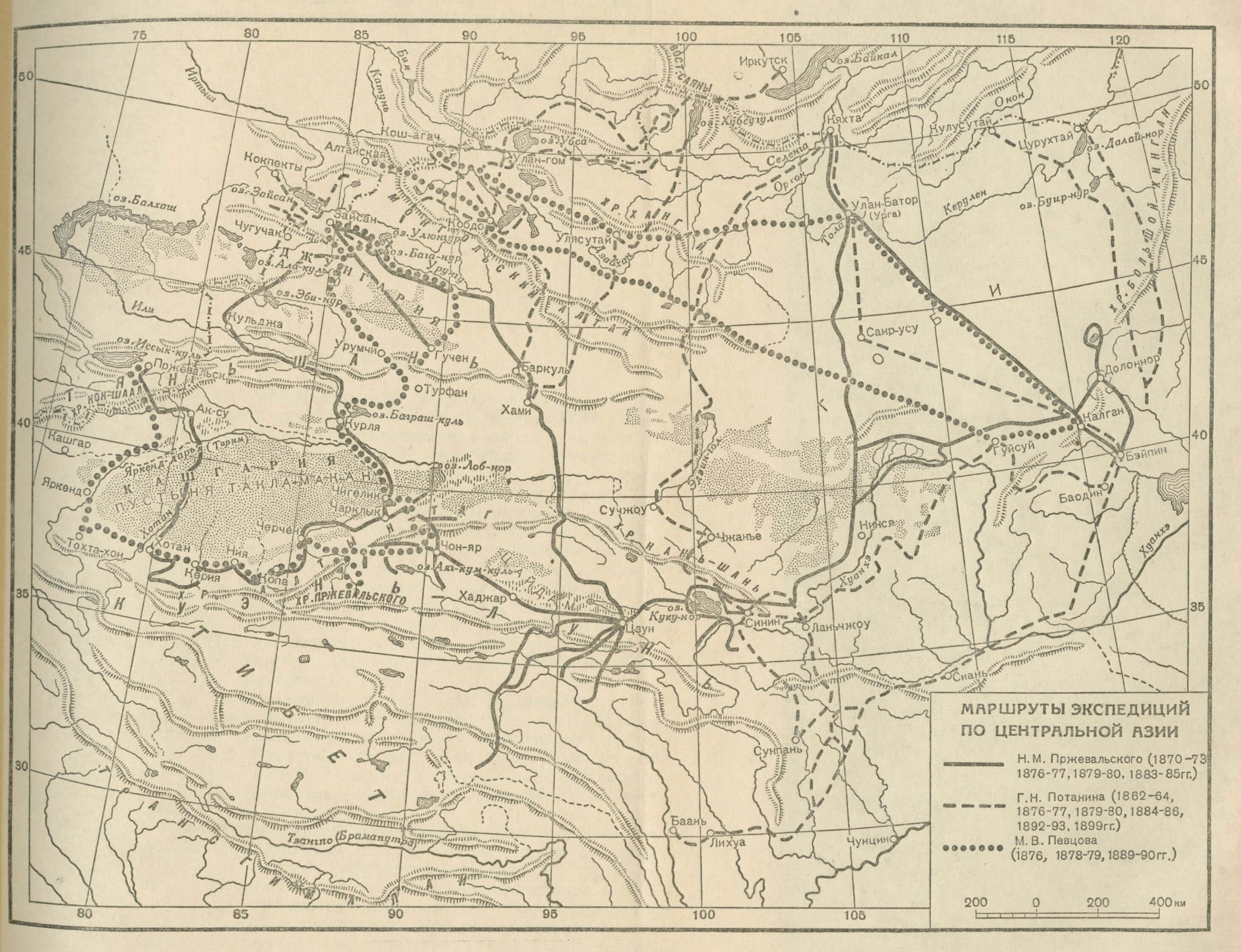
Expedition routes in Central Asia (1949)