Central Asia (1926)

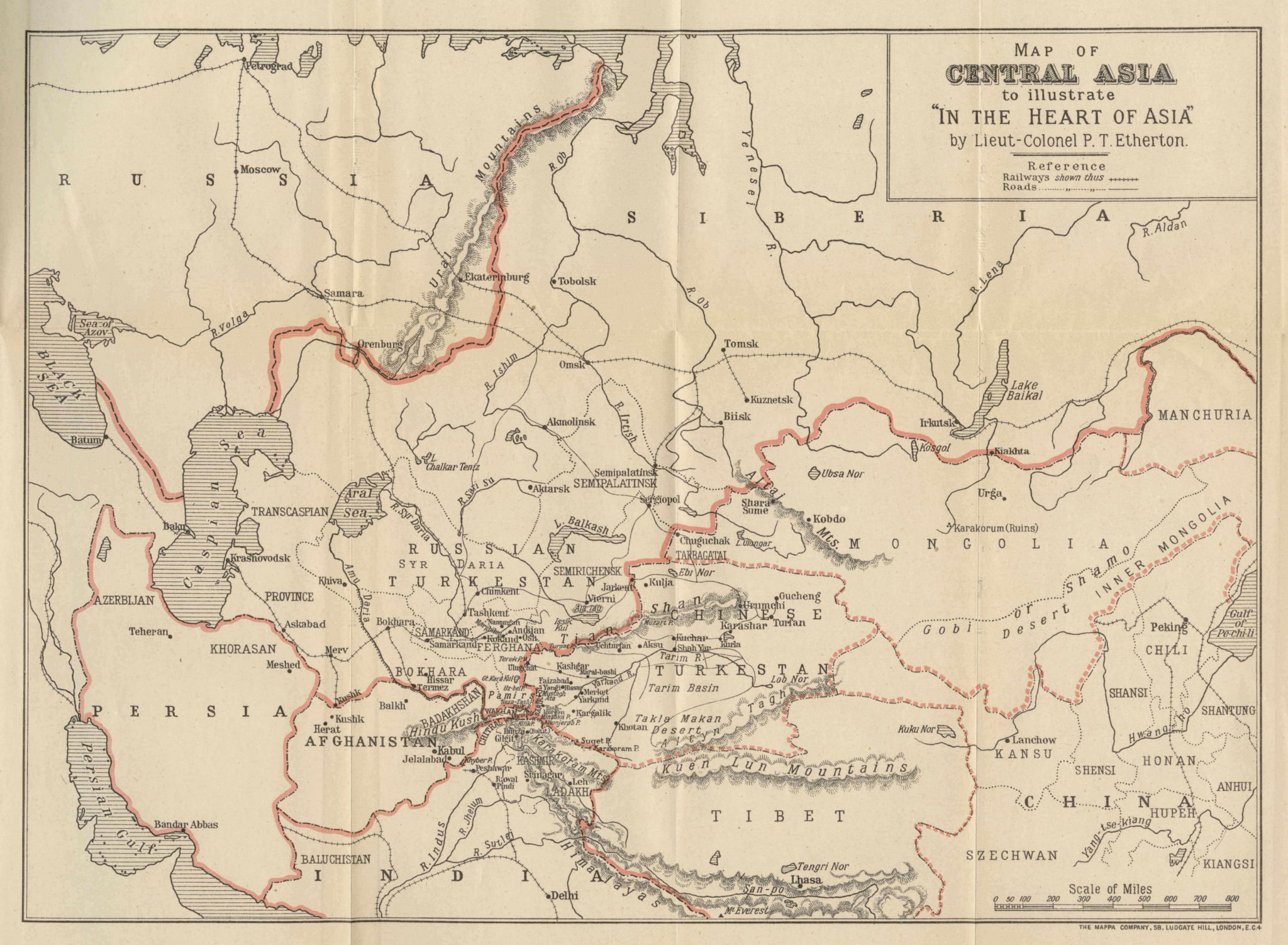
This is a large-scale pencil sketched map of Central Asia from the book In the Heart of Asia (1926) written by British Consul-General in Chinese Turkistan, Lieut.-Colonel P.T. Etherton, while on a secret mission to gather information about Bolshevik propaganda methods in Central Asia in 1918. The present map contains such geographical names as Petrograd, Moscow, the Ural Mountains and Siberia to the north, Persia, the Persian Gulf, Afghanistan, India and Tibet to the south, the Black Sea, the Caspian Sea and the Aral Sea to the west, and Mongolia and the Gobi desert to the East. In the center of the map one finds the cities of Samarkand, Fergana, Bokhara and Tashkent in Russian Turkestan as well as Urumchi, Kashgar, the Takla Makan desert, and the Pamir Mountains in Chinese Turkestan. Railways and roads are marked out on the map in a rather detailed manner.
