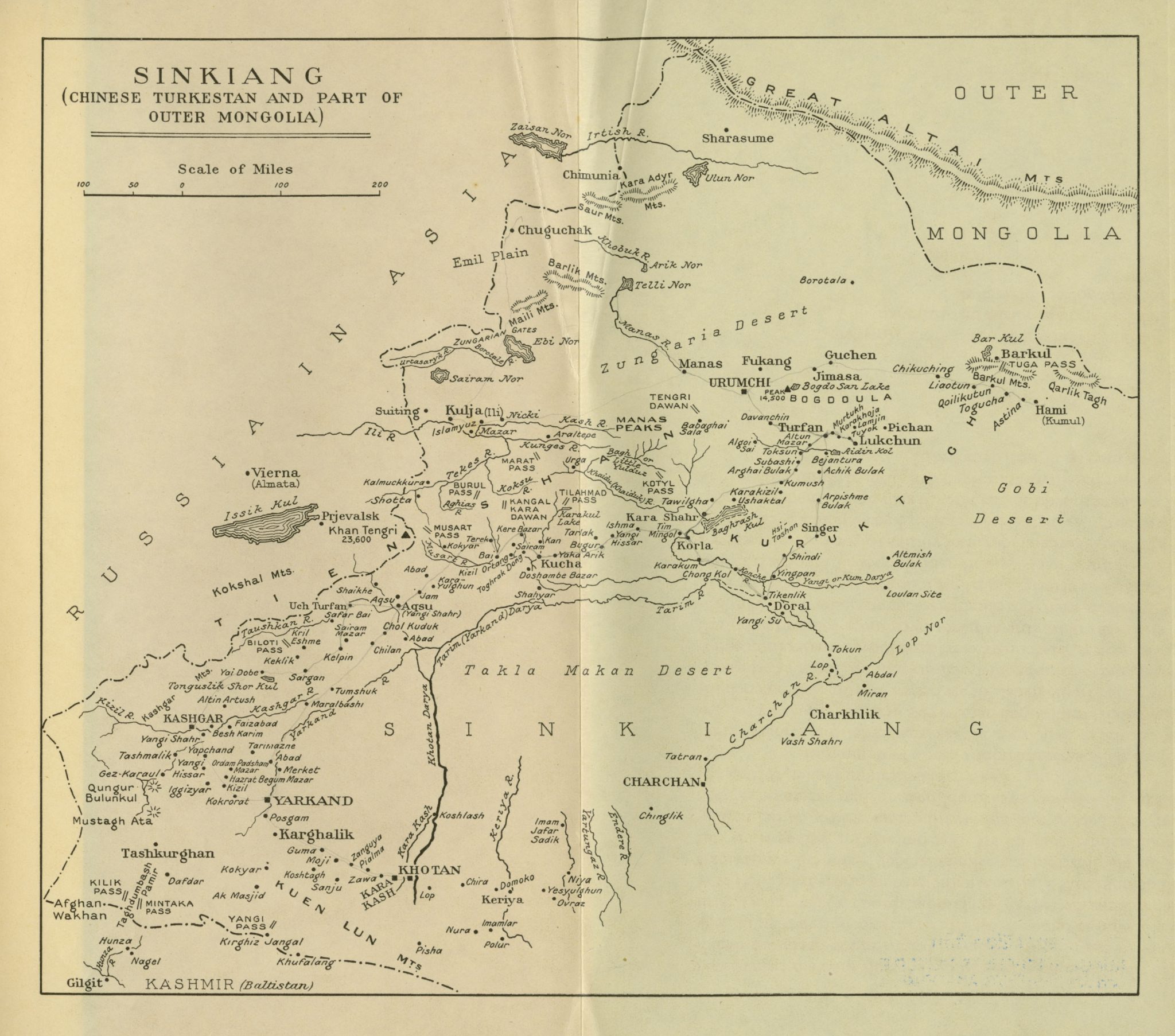
Sinkiang (Chinese Turkestan and part of outer Mongolia (1933)

This map is to be found in an appendix to Peaks and Plains of Central Asia (1933), a report of two journeys carried out in Sinkiang in 1927-1929 and 1930-1931 written by Colonel R.C.F. Schomberg. In addition, two smaller maps of Sinkiang are included in the book, on pp. 88f.
It is a detailed map showing the position and names of towns and villages around the Takla Makan desert and along the rivers of Sinkiang. From the south-west runs a strip across the map towards the north-east with names of villages, lakes and passes around cities and larger settlements like Gilgit, Khotan, Karghalik, Yarkand, Kashgar, Aksu, Kucha, Korla, Kulja, Urumchi, Turfan, and Barkul. To the north are the Altai Mountains and the border to Mongolia, and to the south the Kuen Lun Mountains and the border on Kashmir, while the Gobi desert appears to the east.
