Carte ethnographique de l’Asie centrale (1878)

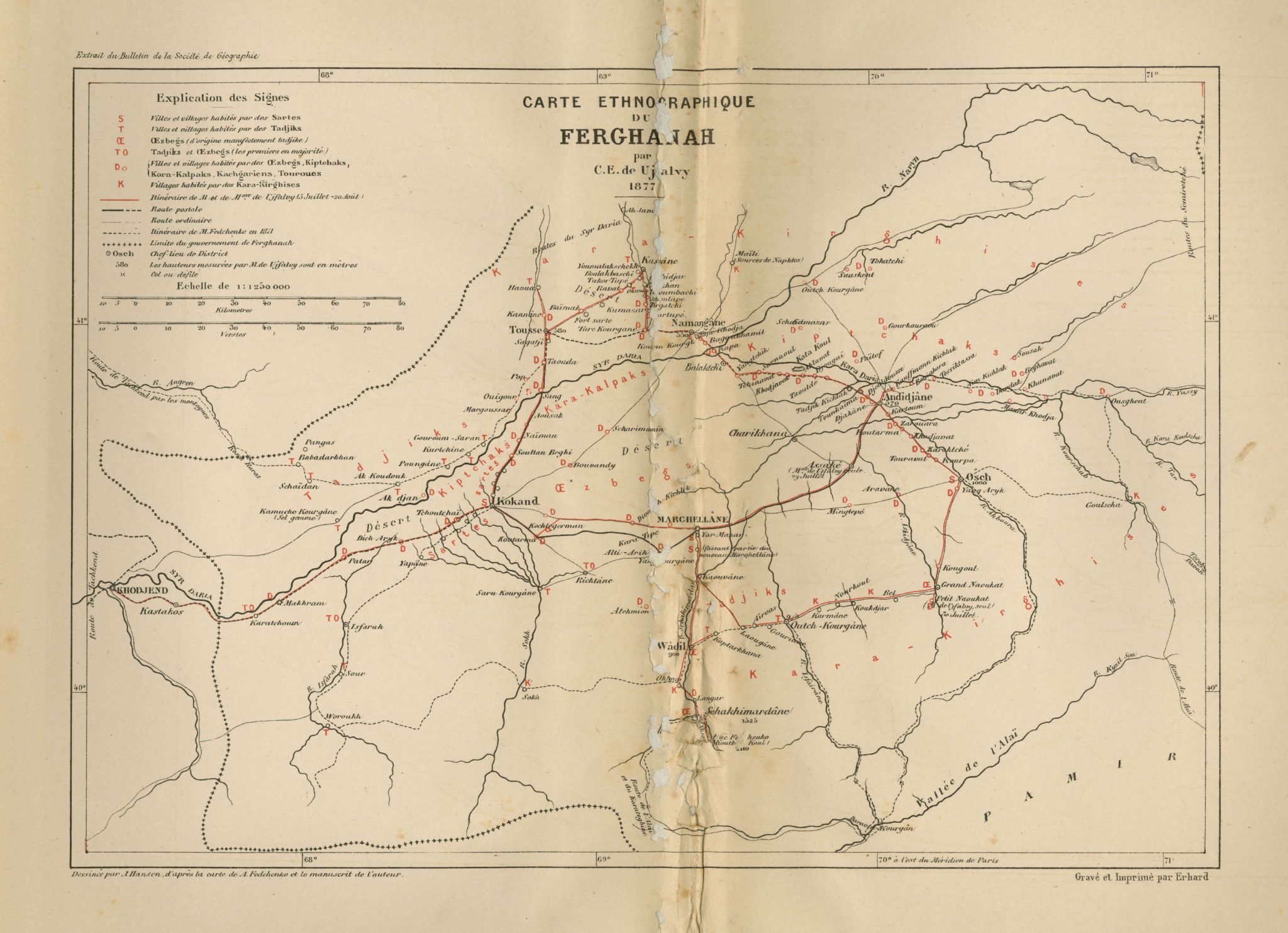
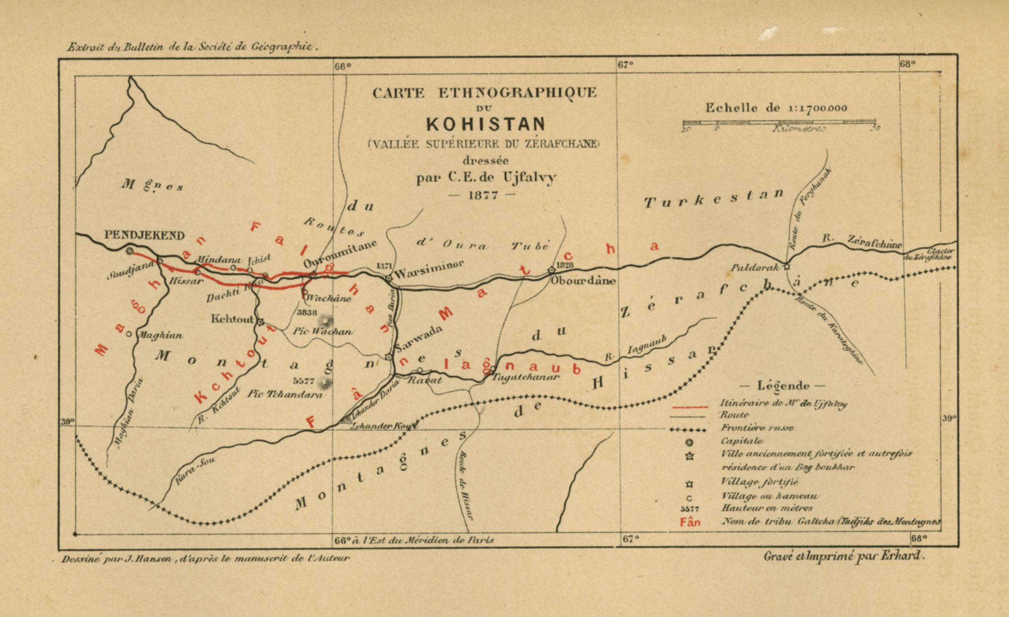
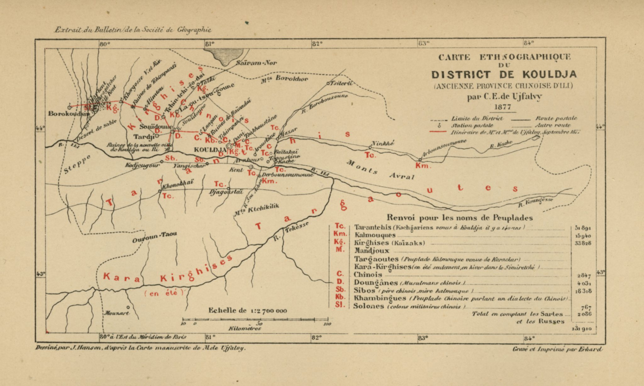
This is a color-coded ethnographic map of Central Asia accompanying Charles Eugène de Ujfalvy de Mezö-Kovesd’s account of his anthropological and ethnographic research conducted in Russian Turkestan in 1877. Besides this map, three other maps of Kohistan, Fergana and Kulja, and some twenty tables with data containing physical descriptions of the inhabitants of the these regions can be found in an appendix to Le Kohistan, le Ferghanah & Kouldja: Expédition scientifique Française en Russie, en Sibérie et dans le Turkestan (1878).
The distribution of ethnicities in Central Asia is demonstrated by a variety of colors:
Pink: Tajik and Galcha people
Green: Kirgiz and Kazaks
Yellow: Kara-Kirgiz and Kirgiz-Kipchaks
Blue: Sarts (a term for settled people and city people in Fergana), Uzbeks, and Kara-Kalpaks as well as other ethnicities
Purple: Kalmyks and others
Orange: Chinese and Dungans (Chinese Muslims), among others
Red flags indicate the presence of Russians.
As to geographical information, the following names appear on this map: The Karakorum and Kuen Lun mountains, to the south, the Takla Makan desert and the cities of Kashgar, Yarkand, and Khotan, in the center, and finally, to the west, the Kyzylkum desert and cities such as Samarkand, Tashkent, Kokand, and Marghelan.
See also:
Le Kohistan le Ferghanah & Kouldja (1878)
Carte ethnographique du Kohistan (1878)
Carte ethnographique du district de Kouldja (1878)
Carte ethnographique du Ferghanah (1878)