Carte ethnographique du Kohistan (1878)

This is an ethnographic map of the region of Kohistan from the scientific report Le Kohistan, le Ferghanah & Kouldja: Expédition scientifique Française en Russie, en Sibérie et dans le Turkestan (1878) written by Charles Eugène de Ujfalvy de Mezö-Kovesd. Along with three other ethnographic maps depicting different areas of Russian Turkestan, and some twenty tables with anthropological data of the inhabitants of these regions, it accompanies a detailed account of anthropological and ethnographic research conducted in Russian Turkestan in 1877. In the present map, the names of different Galcha tribes inhabiting the region are in red. The Zarafshan River flows across the region and passes through the capital Panjakent to the west. The travel route of the author is marked out along with other roads in the region, as well as the presence of fortifications and settlements.
See also:
Le Kohistan le Ferghanah & Kouldja (1878)
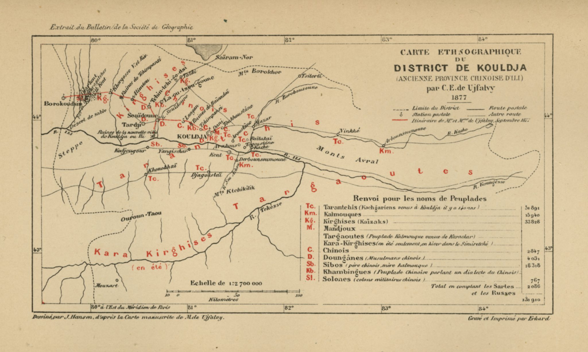
Carte ethnographique du district de Kouldja (1878)
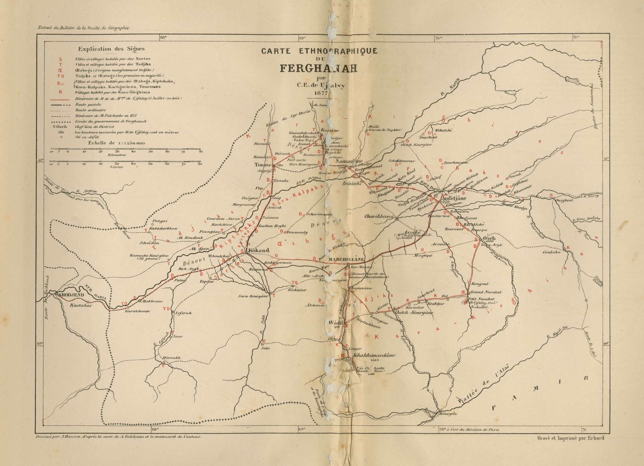
Carte ethnographique du Ferghanah (1878)
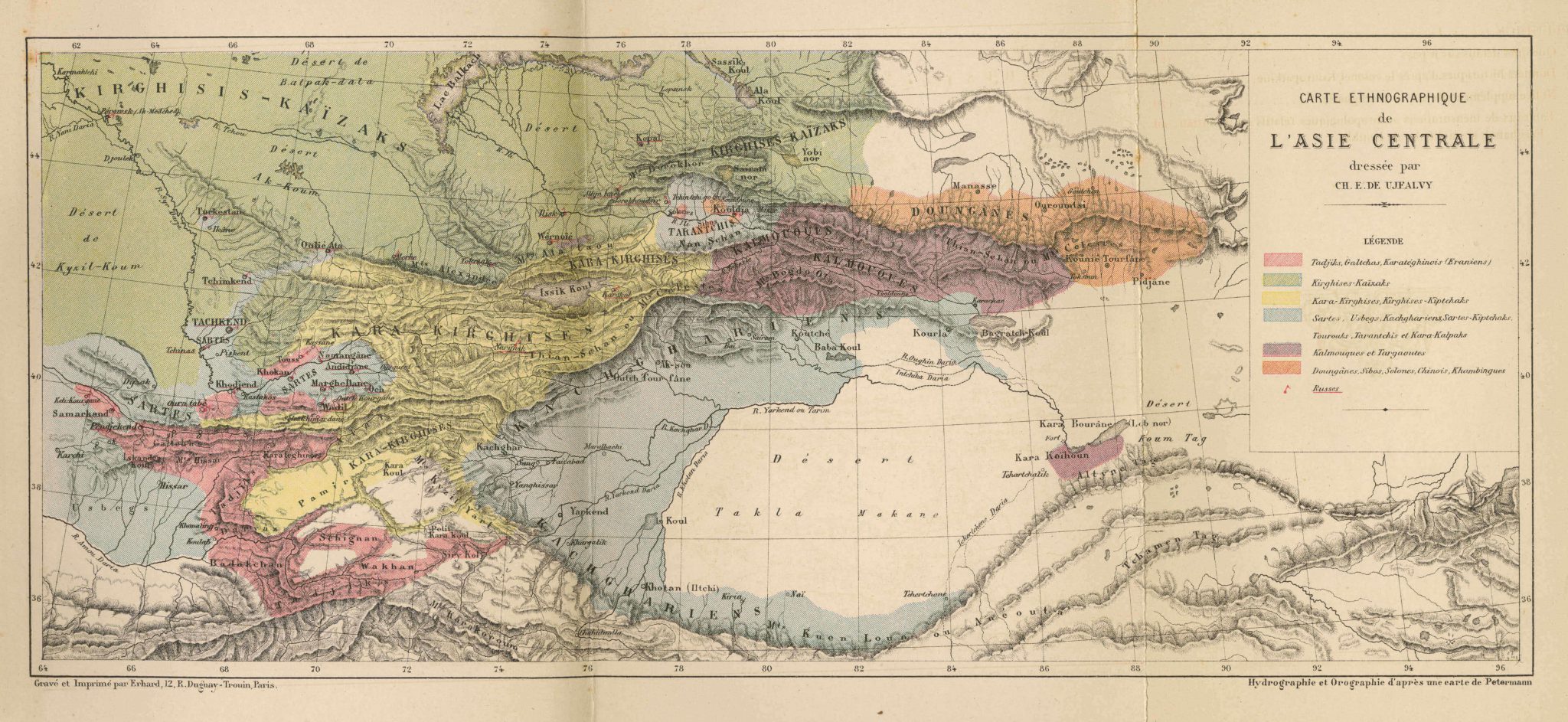
Carte ethnographique de l’Asie centrale (1878)
.