Route survey of Niya, the Sorgak gold mines and Mazar Injelik Khanum (1892)

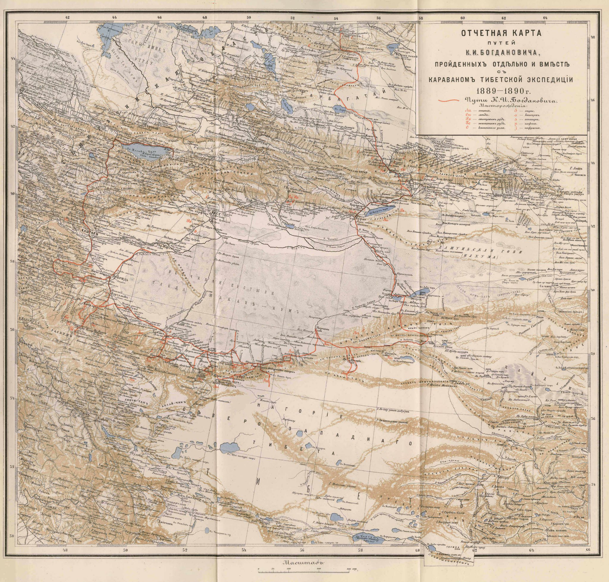
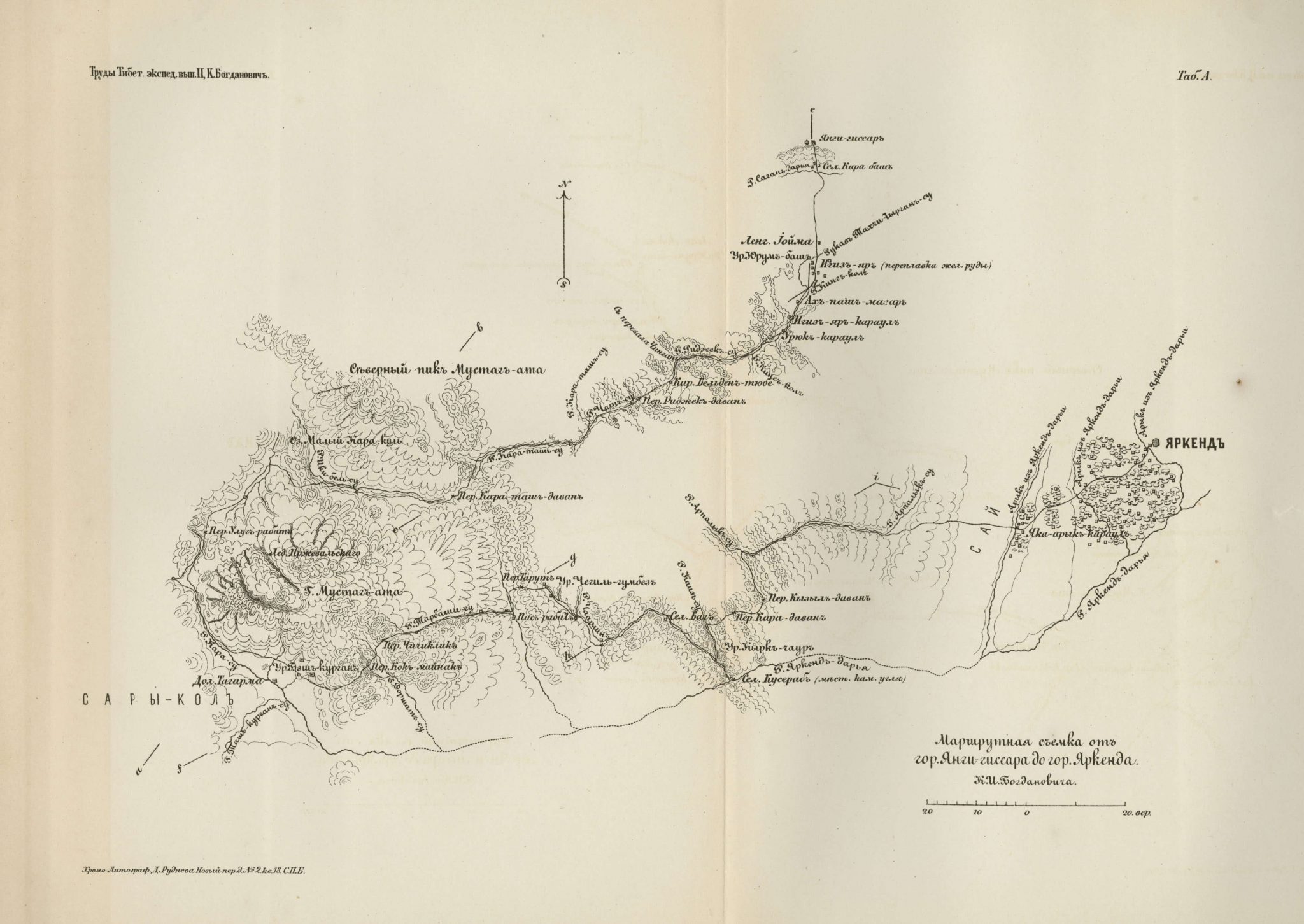
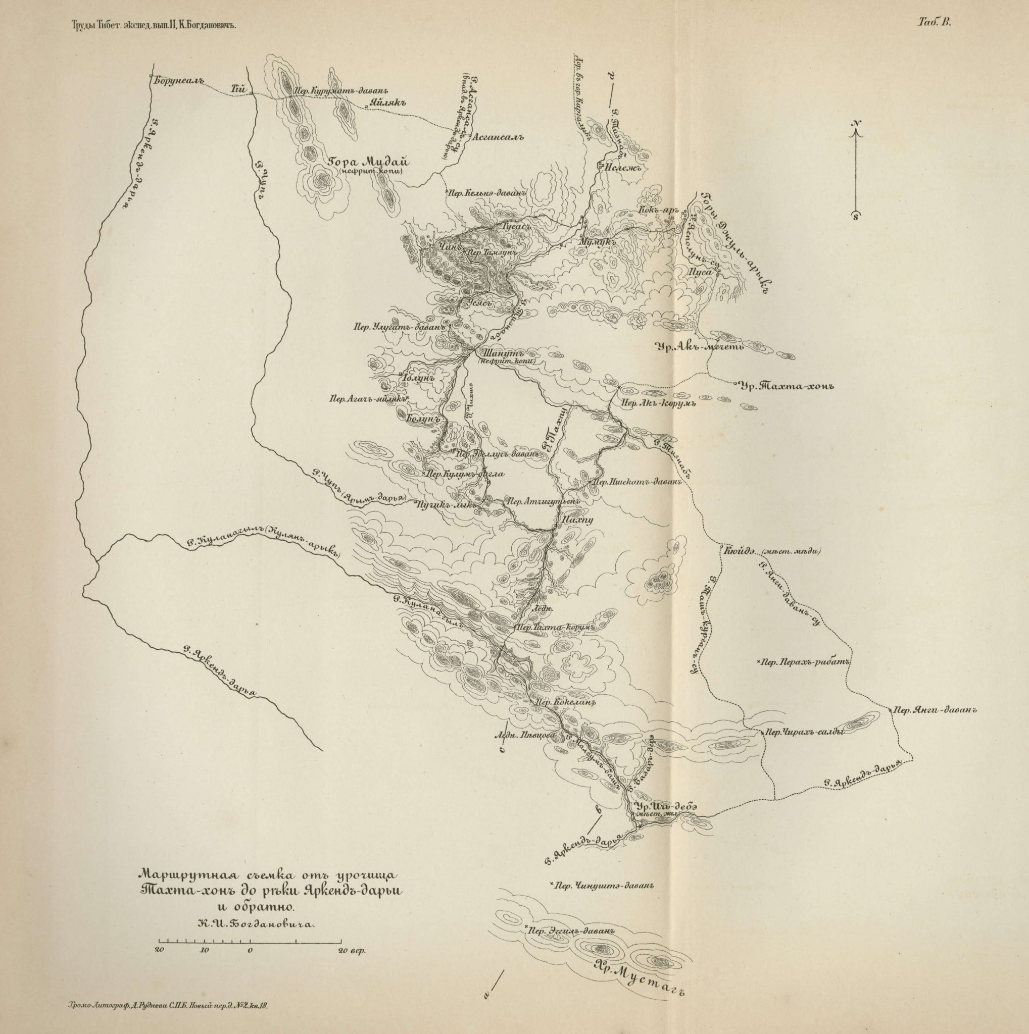
This map can be found in appendix to the second volume of Труды тибетской экспедиции 1889-1890 гг. подъ начальствомъ М. В. Певцова [Works of the Tibetan expeditions 1889–1890 under the authority of M. V. Pevtsov] edited by M. V. Pevtsov and published by the Russian Geographical Society in 1892.
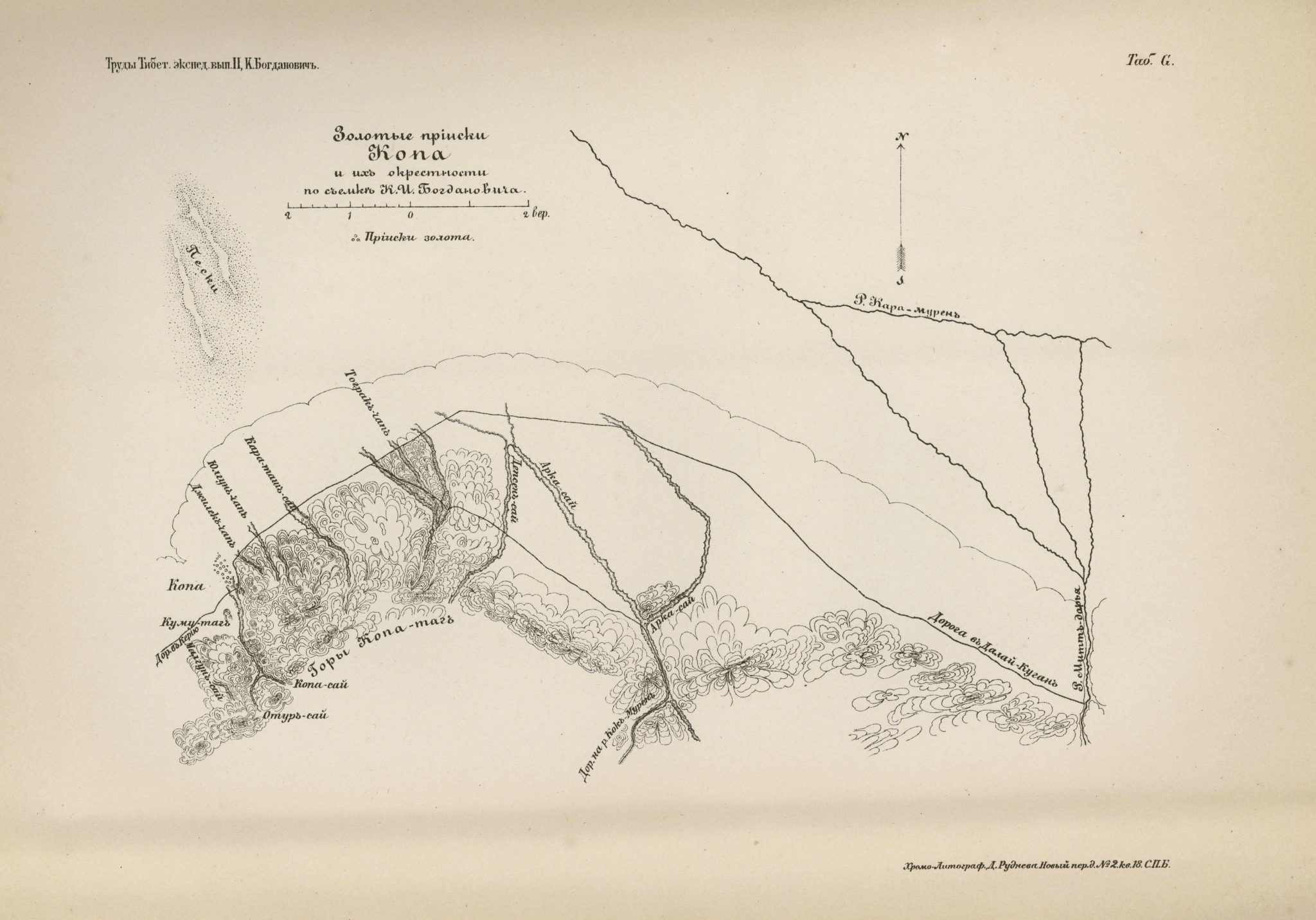
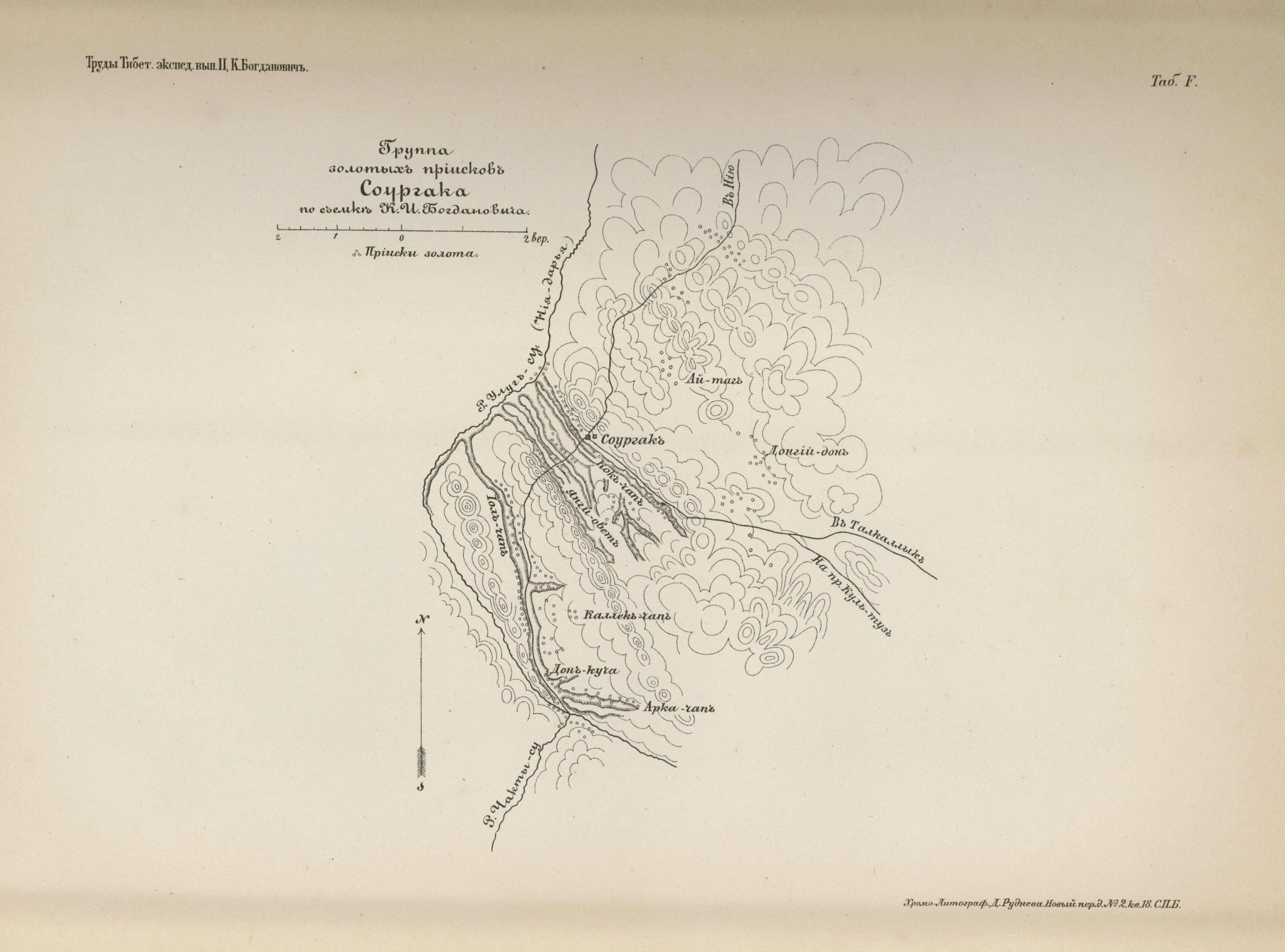
Based on data compiled by the geologist and mining engineer, K.I. Bogdanovich, this map is a route survey of an area south of the Takla Makan Desert and north of the Kunlun Mountains. The ancient city of Niya is marked to the northwest of the map and Mazar Injelik Khanum to the east. Areas with gold mines are marked with three dots. The Sorgak gold mines are illustrated in more detail in another map which can be found in the same volume as the present map.
Seven other maps can be found in appendix to the same volume: one large-scale overview of Eastern Turkestan and four additional small-scaled route surveys of areas to the south and west of the Takla Makan Desert, as well as two sketch-maps of areas with gold mines.
See also:
Eastern Turkestan and travel route of K.I Bogdanovich (1892)
Survey of route between Yangi Hissar and Yarkand via Sarikol (1892)
Route survey of the area surrounding Tahta Hon and the Yarkand River (1892)
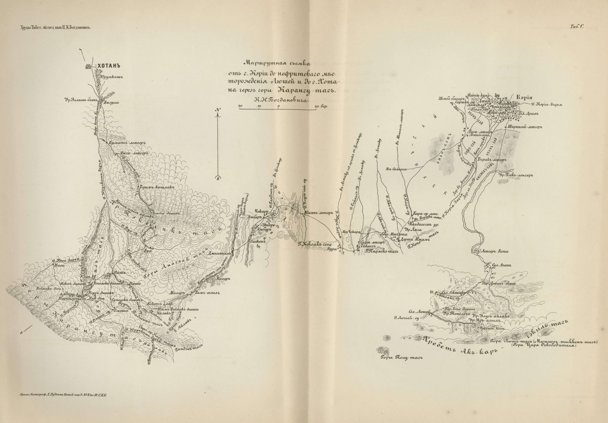
Route survey from Keriya to Hotan and the Karang-tagh Mountains (1892)
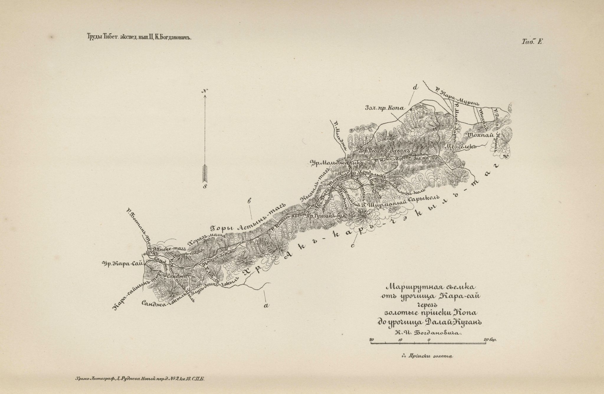
Route survey of Karasai, the Kopa gold mines and Dalai-Kurgan (1892)
Gold mines of Sorgak (1892)
Gold mines in Kopa and the surroundings (1892)