Bagrash-Kul Lake (1896)

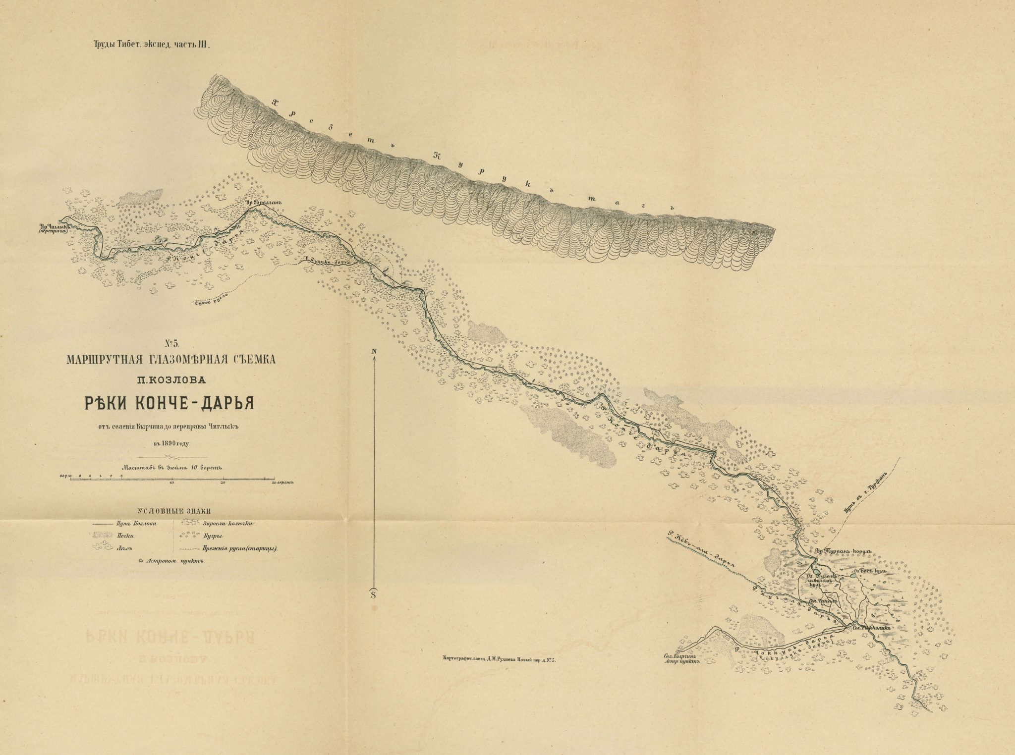
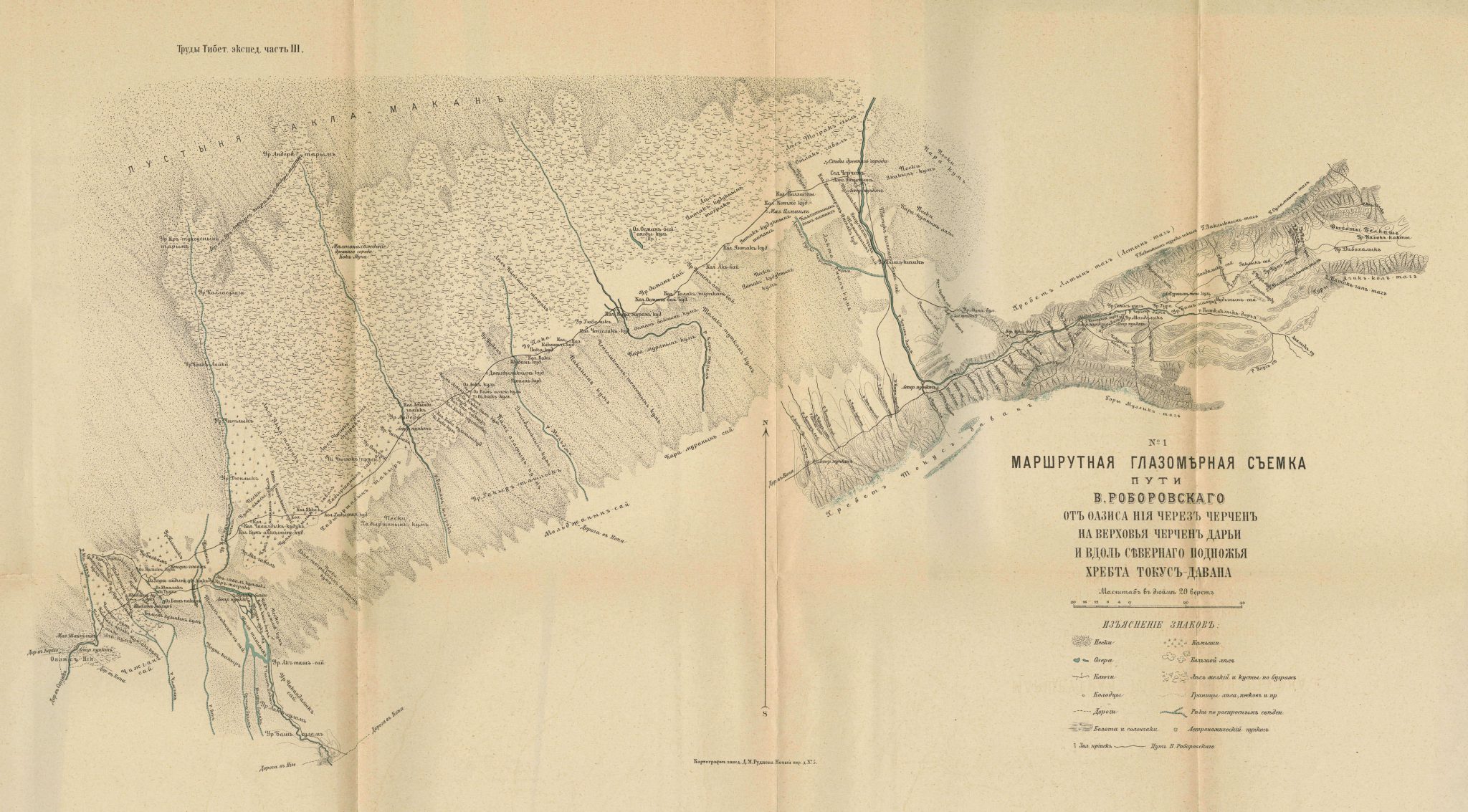
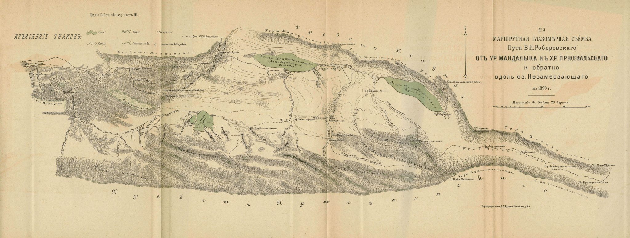
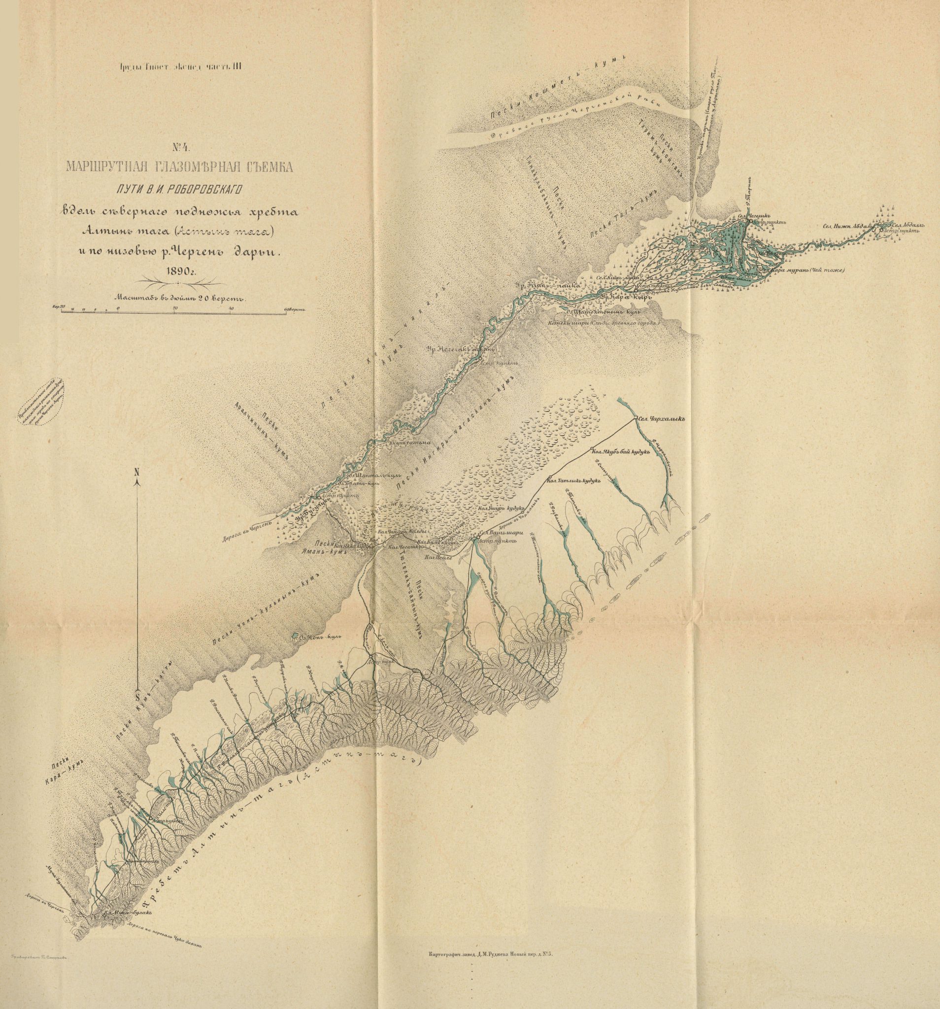
This map can be found in appendix to the third volume of Труды тибетской экспедиции 1889-1890 гг. подъ начальствомъ М. В. Певцова [Works of the Tibetan expeditions 1889–1890 under the leadership of M. V. Pevtsov] edited by M. V. Pevtsov and published in 1896.
It is a map of the Bagrash-Kul Lake, also known as Bosten Lake (Bosten Hu), which is situated northeast of the Takla Makan Desert. South of Bagrash-Kul Lake one can find the Ak-bel kum Desert and Kara-mekan-ula Mountain. The city of Karashar is marked to the northwest of the map and Korla to the west. The travel routes of Russian explorers Roborovski and Koslov are marked north of the Bagrash-Kul Lake.
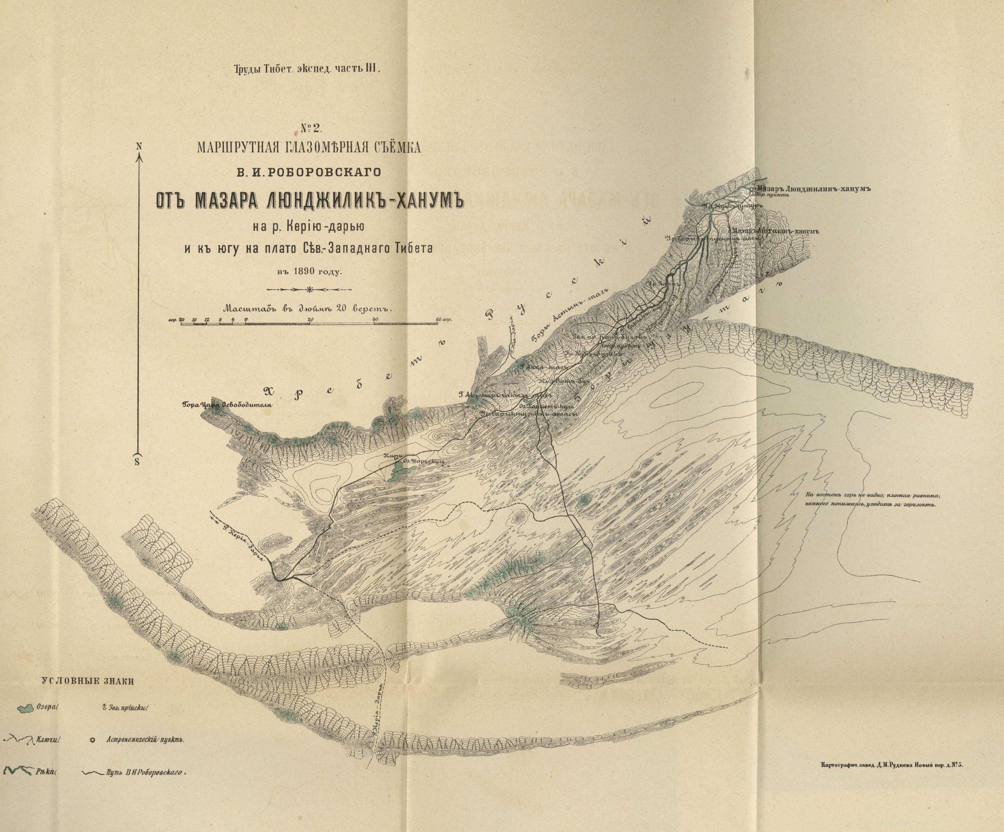
Five other maps are appended to this volume illustrating areas around the Cherchen oasis, Keriya River, Przhevalsky Mountains in southeast Sinkiang, Altyn Tagh, and Konche River.
See also:
The Cherchen oasis (1896)
Przhevalsky Mountain (1896)
Altyn Tagh & the Cherchen River (1896)
Keriya River (1896)
Konche River (1896)